When we first started unit studies of different countries I thought it was important to make a 3d map of the country and its topography. We started our study in the Arctic where we made a salt map of Greenland. It was a fun activity and we enjoyed painting the dried salt map and marking different towns. The problem came when we were done with our study of Greenland. It was difficult to throw away something we had made so carefully and I didn’t want to take a bunch of space to start storing the salt maps of different countries. So I decided to try to make an edible version of a map.
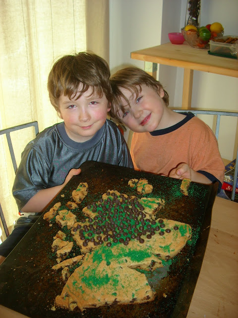
The next country we studied was in Europe. I had made cookie dough and shaped it to look like Scotland before I put it in the oven. That was a mistake! Once removed from the oven it no longer looked like it was Scotland. I had to cut it to look like the country. I then had my boys decorate the country.
We put chocolate chips on the cake to represent mountains and green to represent grassy areas.
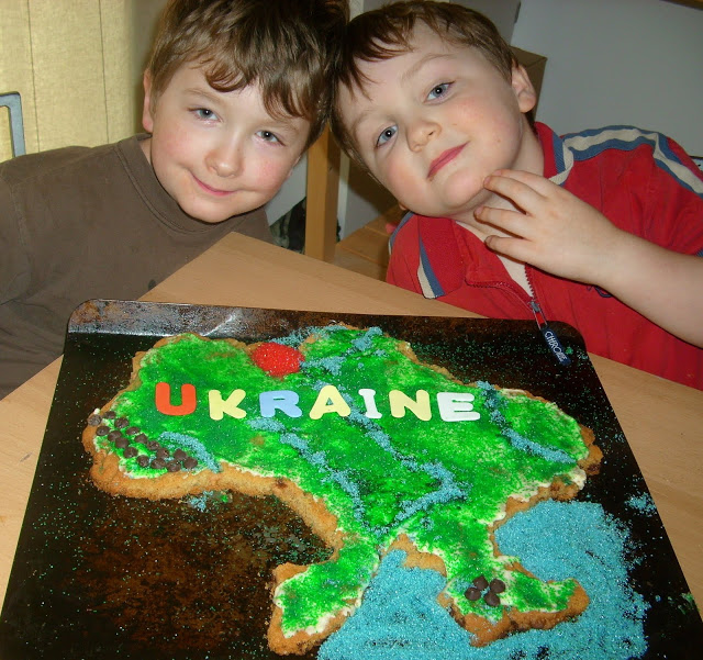
The next country we studied was the country of Ukraine. This time I baked a sheet of dough and then cut it to the shape of the country.
For Ukraine we used green and blue sugar to represent grassy areas and water. The chocolate chips represented mountainous areas. My five year old dumped a whole bunch of red in the area of Chernobyl. We put some frosting on the cookie cake to help the sugar stick.
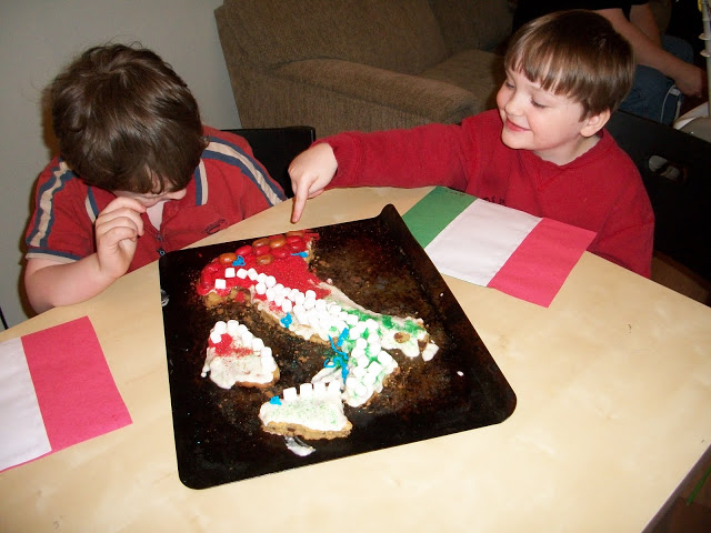
The latest one we did was for Italy. When it came time to do the cake I realized I had no extra chocolate chips for mountains so we improvised. We used marshmallows for smaller mountains and hard candies for the larger mountains. We used red and green sugar to show the colors on the Italy flag.
So there you have it. As we continue to travel around the world we will continue to make these cookie concoctions. If you spend a week in each country and tried this idea you would never run out! We spend at least 4-6 weeks studying one country so a cookie cake works out well for us. My boys enjoy eating different parts of a country too. And when it is all said and done, there is nothing to store or throw away. I like that!
I love your map. Very nice.
I love your maps! They are awesome.
We also like to do edible projects for school: meals based on the country or time period we are studying, maps made on sheet cakes, sugar cookie cunieform, gingerbread fossils, sheet cookie and dried fruit mossaics. For some reason, the kids are much more willing to help “clean up” after a project like this. 😉
Oh, I love this! I’m so glad you submitted it to Hands-On Carnival so I could pop by and see your blog. I’m going to have to look around now. 🙂
I love the idea of an edible map. I am going to consider this for next year.
Blessings,
Dawn
Wow! Such impressive maps. We’ve done salt dough, but I’m really seeing the advantage of a huge edible cookie! 🙂
BTW — This post would be fantastic for the next Hands-on Homeschool Carnival which will be April 14. You can submit it here. I hope you will.
These are fantastic! We’re “following” some friends on their 5,800-mile road trip right now… may have to do one of the US and mark out their path. 🙂
Thanks!
Cool. I’m going to think about doing something in my study guides that will be different. Thanks for the heads up.
Elysabeth Eldering
Author of the Junior Geography Detective Squad, 50-state, mystery, trivia series
STATE OF WILDERNESS, now available
STATE OF QUARRIES, now available
STATE OF RESERVATIONS, coming April/May 2010
STATE OF ALTITUDE, coming May/June 2010
http://junior-geography-detective-squad.weebly.com
http://jgdsseries.blogspot.com
I used chocolate chip cookie dough. I make the Tollhouse Cookie Dough recipe. I’m sure other dough would work fine too.
Very cool idea. I’m looking for new ideas to include in my study guides for my state series. This is an idea I can use for some of the states. Create a map of the state and show the topography. Do you use like the sugar cookie roll and instead of cutting just roller pin it out on the cookie sheet? Or do you make your own cookie dough? So far of four study guides I’ve completed I’ve had one map/math skills section and three science experiments. For the fifth one, I’m thinking of doing a diorama or something artsy for the section instead of science, but I need to include something else in it, maybe some basic math too since I can’t just have art as a curriculum. I’ll figure something out. Thanks for the posting on your edible countries. – E 🙂
———-
Elysabeth Eldering
Author of the Junior Geography Detective Squad, 50-state, mystery, trivia series
STATE OF WILDERNESS, now available
STATE OF QUARRIES, now available
STATE OF RESERVATIONS, coming April/May 2010
STATE OF ALTITUDE, coming May/June 2010
http://junior-geography-detective-squad.weebly.com
http://jgdsseries.blogspot.com